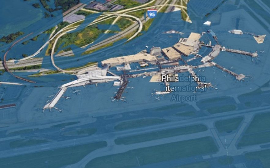
The Philadelphia International Airport is not looking at a bright future if sea levels continue to rise at their current pace, writes Melissa Romero for Curbed Philadelphia.
The Google Map overlay – entitled “Surging Seas: Extreme Scenario 2100” – highlights the worst-case effects of rising sea levels across all parts of the nation. The interactive map that was created by the nonprofit organization Climate Central shows the airport submerged under water by the end of this century.
[uam_ad id=”52851″]
Advertisement
The airport is not the only part of Philadelphia in great danger of ending up below sea level. Other major landmarks and places will no longer exist, including FDR Park and the Navy Yard.
According to Climate Central’s previous estimates, area waters in Philadelphia could end up rising 19 inches by 2050, and increasing an additional four feet or even more by 2100.
Read more about the effects of rising sea levels at Curbed Philadelphia by clicking here.
[uam_ad id=”52850″]