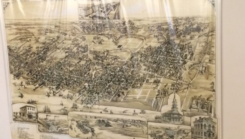
A copy of an 1874 map of Chester donated to the Delaware County Historical Society by Alan C. Holcombe and his wife captures a special time in the city’s history, according to a report from the Delaware County News Network.
The original of the map is housed at the Library of Congress. The 15-by-12-foot copy was made by Holcombe, 84, a Chester High alum who wanted to share the adoration he felt for his native city with every person he could.
The map shows Chester at a time when boats busily sailed up and down its shores. A number of sites from the city’s past are on the map, including the Leather Maker, the Spencer McIlvain Lumber Yard, and Chester Worsted Mills.
The couple made the donation of the map around 10 years ago.
“I wanted to give it to the society so they could hang it up so people could enjoy it,” said Holcombe. “I wanted to leave something for people to see of the old city.”
Read more about the map from the Delaware County News Network by clicking here.