New York Times: Pennsylvania’s New Congressional Map Close to Achieving Partisan Balance
Pennsylvania’s new congressional map released by the Pennsylvania Supreme Court comes close to achieving partisan balance, write Nate Cohn, Matthew Bloch, and Kevin Quealy for The New York Times.
The map meets all standard nonpartisan criteria, including being compact, minimizing split counties and municipalities, and preserving communities of interest.
But the new map is much more favorable to Democrats, who now have a chance to challenge the six incumbent Republicans in districts that moved to the left.
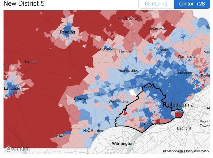
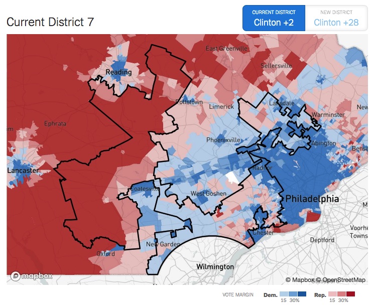
One of the biggest changes is in the Seventh District, which had been so gerrymandered that it resembles everything from a moose with antlers to Goofy kicking Donald Duck. The new Fifth District is compact and follows jurisdictional lines. It includes all of Delaware County and better represents the Philadelphia suburbs.
The current Sixth District retains its name but with new borders. This was the biggest challenge, as it is supposed to cover seven-tenths of a district from the Philadelphia area together with three-tenths from outside. It now covers more of Chester County and extends into Reading.
Read more about Pennsylvania’s new congressional map in The New York Times by clicking here.
[uam_ad id=”58332″]
Join Our Community
Never miss a Delaware County story!
"*" indicates required fields